In DeSoto County, Mississippi, the Chancery Court Clerk’s Land Records Department officially records all deeds, liens, and other land documents to create the binding history of ownership and encumbrances. The County Tax Assessor also organizes property data primarily for valuation and taxation.
Beyond these county-maintained records, each of the region’s five municipalities maintains property records that provide detailed information on land use, improvements, and regulatory compliance within its jurisdiction.
The county maintains a stable, growing housing market, with median home values reaching $217,900.00 and rents averaging $1,229.00. Strong household incomes of $78,681.00 help residents manage property tax obligations of around 0.66%.
How to Search for Property Records in DeSoto County

Individuals seeking real property information in DeSoto County, MS, gather the data they need through official online resources and hands-on in-office research.
The Public Records Search website, maintained by the DeSoto County Chancery Court Clerk's Office, provides indexed deeds, mortgages, liens, releases, plats, and other legal property documents. Users can search by name, legal description, or book and page number.
Meanwhile, the County Tax Assessor's Land Records Database delivers sales information, tax history, and improvement documentation. This helps individuals assess property value trends and review structural updates efficiently.
For older or historical records, online searches often fall short. Researchers must visit the Land Records Department of the County Chancery Court Clerk's Office and consult abstract books or microfilm. This often requires manual lookups by book and page, so individuals frequently ask for staff assistance to ensure they locate the correct records.
DeSoto County operates multiple websites for land records, including the dedicated Public Records Search website and an "Old Land Records" site for documents before November 30, 2019. Users might struggle to know which system contains the necessary document, which requires searches in both locations.
PropertyChecker eliminates the need to search multiple DeSoto County websites by consolidating both modern and historical records into a single search interface. Users can access public documents while also tracing a property's full transaction history, mortgage activity, and building improvement details.
 Property Ownership and Title Information
The most efficient way to locate property ownership details and track title history in DeSoto County is through the Public Records Search website maintained by the County Chancery Court Clerk’s Office.
Users can enter the grantor or grantee name, property address, or the book and page number to access recorded deeds, mortgage documents, and liens quickly. These records establish current ownership, document transfers over time, and reveal any encumbrances that may affect the property’s legal status.
 Property Sales and Transaction History
Authoritative property sales data regarding arm’s-length transactions in DeSoto County is primarily accessible through the County Tax Assessor’s Land Records Database. When available, the database provides party names, sale prices, and transaction dates.
The County Tax Assessor’s database supports quick lookups of a property’s most recent sale date and price, while PropertyChecker offers a more comprehensive history of property transactions. In addition to basic sales data, PropertyChecker may include mortgage information and renovation history, which can help users better understand a property’s investment value.
 Property Tax Assessment and Payment Records
In DeSoto County, the County Tax Assessor’s Office appraises property and determines its assessed value for tax purposes. Led by a separate elected official, the County Tax Collector’s Office collects taxes on real property.
The Tax Assessor’s Land Records Database contains information on land appraisals, building values, and total assessed values. Meanwhile, the Online Tax Receipt Inquiry portal from the County Tax Collector’s Office displays the current year tax amount, payment status (paid/unpaid), receipt history, and installment payments.
Property owners contesting the assessment can file a written protest with the Board of Equalization within the strict deadline, often by late July.
 Property Characteristics and Parcel Details
Detailed data for land and structures in DeSoto County is accessible through the County Tax Assessor’s Land Records Database. Using this tool, researchers can identify parcels by searching by landowner’s name, property address, subdivision/lot, or section/township/range.
Typical land and building details available include total acreage, frontage dimensions, lot size, construction type, age, condition, and amenities.
 Zoning, Land Use, and Planning Records
Individuals may contact the DeSoto County Planning Department for zoning cases, subdivision regulations, comprehensive plans, and site plan reviews. Operating under the supervision of the DeSoto Planning Commission, the department handles these matters for unincorporated areas of the county.
It implements the Interactive Map, which enables users to check a specific parcel’s current zoning and land use. They can also visit the Document Center to review the county’s 2030 Comprehensive Plan, Zoning Ordinance, Subdivision Ordinance, and Flood Ordinance.
 Legal Documents Affecting Property
The DeSoto County Chancery Court Clerk’s Office and its Land Records Department hold deeds, mortgages, liens, releases, homestead declarations, land restrictions, maps, plats, judgments, and other legal real property documents.
Indexed information and scanned images of many modern real property documents are accessible via the Public Records Search website. These records are generally searchable by name, record date, subdivision lot, section-township-range, or book and page number.
The website also has a non-indexed search function that enables users to view digitized images of older or specialized documents that have not yet been indexed into the online database by name.
 Building Permits, Inspections, and Construction Records
Building permit records, on-site inspection reports, structural plans, and contractor and subcontractor licensing details for properties outside city limits are accessible through the DeSoto County Citizen Self-Service Portal.
Moreover, researchers can contact the Building Department within the DeSoto Planning Commission by phone or email to verify whether a permit exists or to obtain the results of a final inspection. They must provide the property address or parcel number.
 Maps and Visual Property Data
Maintained by the DeSoto County GIS Department, the County GIS Hub is the one-stop shop for geospatial data in the county.
The platform allows users to view high-resolution photographs overlaid with parcel lines, explore layers for flood zones, wetlands, drainage districts, and school districts, and use various specialized mapping applications.
DeSoto County spans approximately 476 square miles. This land, based on the current records, is divided into over 84,000 parcels.
DeSoto County Property Statistics
Displayed here are charts summarizing the county's tax rates, accompanied by insights into median home values, income figures, and rent rates.

Median Rent
| Mississippi |
$725.50
|
| National |
$840.25
|
-
+69.4 %vs Mississippi
-
+46.3 %vs National

Median Home Value
| Mississippi |
$102,350.00
|
| National |
$173,750.00
|
-
+112.9 %vs Mississippi
-
+25.4 %vs National

Median Household Income
| Mississippi |
$44,600.00
|
| National |
$65,108.00
|
-
+76.4 %vs Mississippi
-
+20.8 %vs National
Median Property Tax Rate
| Mississippi |
0.73%
|
| National |
0.74%
|
-
-9.6%vs Mississippi
-
-10.8 %vs National

Unemployment Rate
| Mississippi |
3.54%
|
| National |
2.87%
|
-
-23.7 %vs Mississippi
-
-5.9 %vs National

Renter Occupied Housing
| Mississippi |
23.88%
|
| National |
21.81%
|
-
-38.1 %vs Mississippi
-
-32.2 %vs National
DeSoto County Registrar of Deeds
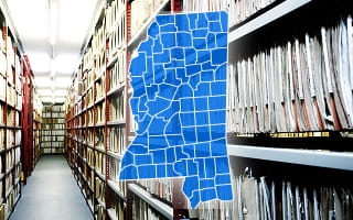
The Land Records Department of the DeSoto County Chancery Court Clerk’s Office is the official registrar of deeds in the county. It serves as the central repository for documents related to real property, including deeds, mortgages, liens, lis pendens, powers of attorney, and healthcare directives.
The DeSoto County Tax Assessor’s Office may review a recorded healthcare directive to identify the individual authorized to act on behalf of an incapacitated property owner. It uses that information to process assessment updates and confirm that only the legally designated representative handles property-related matters.
To locate real property documents, researchers can click the “Searching Records Online” link on the Chancery Court Clerk’s official site and access the Public Records Search website.
For those who need to conduct searches in person, they can use the public terminals at the Land Records Department office in Hernando. Regular copies of documents made in this office cost $0.25 per page, with an additional $1 certification charge for certified copies.
Municipality-Level Property Records Information
The DeSoto County Chancery Court Clerk’s Land Records Department acts as the custodian of official, legally binding documents, such as deeds, mortgages, and plats. However, municipal departments manage records related to how land can be used, improved, and taxed locally.
For example, a homeowner in Olive Branch remodeling their kitchen must obtain a permit through the City of Olive Branch Planning and Building Department. That department maintains the structural plans and final inspection approval on file, separate from the property’s deed held by the county.
DeSoto County consists of five incorporated municipalities, each responsible for regulating and guiding land development within its boundaries.
County Offices That Maintain DeSoto County Property Records
In DeSoto County, these elected authorities and county departments work together to build and maintain a unified system of property records. They capture ownership, taxation, mapping, and land development to give individuals access to the complete profile of every parcel of land:

DeSoto County Tax Assessor’s Office
- 365 Losher St., Suite 100, Hernando, MS 38632
- (662) 469-8029
- (662) 469-8201
DeSoto County Chancery Court Clerk’s Office - Land Records Department
- 311 W South St., Suite C, Hernando, MS 38632
- (662) 469-8397
- chancery@desotocountyms.gov
- (662) 469-8308
DeSoto County Tax Collector’s Office
- 365 Losher St., Suite 100, Hernando, MS 38632
- (662) 469-8030
- (662) 469-8105
DeSoto County Planning Commission - Planning Department
- 65 Losher St., Suite 200, Hernando, MS 38632
- (662) 469-8023
- bhopkins@desotocountyms.gov (Department Director)
- (662) 469-8155
DeSoto County Planning Commission - Building Department
- 65 Losher St., Suite 200, Hernando, MS 38632
- (662) 469-8162 (Chief Building Official)
- dpressgrove@desotocountyms.gov
DeSoto County GIS Department
- 365 Losher St., Suite 350, Hernando, MS 38632
- (662) 469-8019
- jwammack@desotocountyms.gov (GIS Analyst)
Other Counties in Mississippi
- Adams County
- Alcorn County
- Amite County
- Attala County
- Benton County
- Bolivar County
- Calhoun County
- Carroll County
- Chickasaw County
- Choctaw County
- Claiborne County
- Clarke County
- Clay County
- Coahoma County
- Copiah County
- Covington County
- Forrest County
- Franklin County
- George County
- Greene County
- Grenada County
- Hancock County
- Harrison County
- Hinds County
- Holmes County
- Humphreys County
- Issaquena County
- Itawamba County
- Jackson County
- Jasper County
- Jefferson County
- Jefferson Davis County
- Jones County
- Kemper County
- Lafayette County
- Lamar County
- Lauderdale County
- Lawrence County
- Leake County
- Lee County
- Leflore County
- Lincoln County
- Lowndes County
- Madison County
- Marion County
- Marshall County
- Monroe County
- Montgomery County
- Neshoba County
- Newton County
- Noxubee County
- Oktibbeha County
- Panola County
- Pearl River County
- Perry County
- Pike County
- Pontotoc County
- Prentiss County
- Quitman County
- Rankin County
- Scott County
- Sharkey County
- Simpson County
- Smith County
- Stone County
- Sunflower County
- Tallahatchie County
- Tate County
- Tippah County
- Tishomingo County
- Tunica County
- Union County
- Walthall County
- Warren County
- Washington County
- Wayne County
- Webster County
- Wilkinson County
- Winston County
- Yalobusha County
- Yazoo County